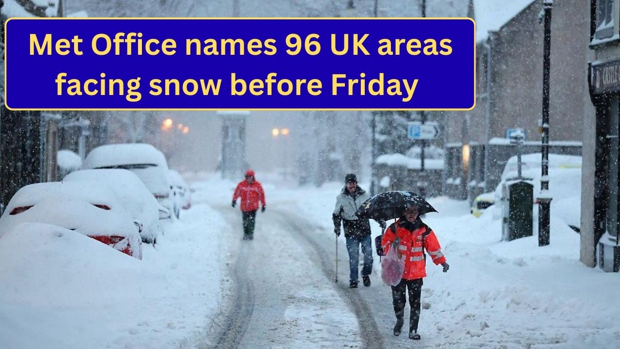
The Met Office has placed 96 areas across the UK under snow and ice warnings ahead of Friday, as a prolonged spell of cold weather increases the risk of snowfall, freezing rain, and dangerous ice.
While not every location will see heavy snow, forecasters warn that even small amounts, combined with sub-zero temperatures overnight, could lead to widespread disruption. The warnings cover much of Scotland, northern and central England, Wales, Northern Ireland, and parts of southern England.
Below is a detailed breakdown of what is driving the warnings, what conditions are expected, and what people should prepare for — followed by a full Q&A section.

What Is Causing the Snow Risk
This weather event is being driven by a slow-moving cold pattern, rather than a single storm. Three factors are combining:
- Cold air already in place, keeping ground temperatures low
- Moist air moving in, producing rain that turns to snow in colder areas
- Clear nights, allowing temperatures to fall sharply and ice to form
Because the system is slow-moving, wintry conditions may repeat over several nights rather than clearing quickly.
When Conditions Will Be Worst
The most hazardous conditions are expected:

- Late evening to early morning
- Overnight into Friday
- During the morning commute
Snow may fall intermittently during the day, but ice is likely to persist well after snowfall ends.
Regional Detail: What Different Areas Can Expect
Scotland
Scotland faces the highest and longest-lasting risk. Snow is expected to settle in many central, eastern, and higher-altitude areas, with icy roads remaining a concern throughout the day.
Northern England
Snowfall is expected to be patchy but disruptive, especially on hills, rural roads, and overnight routes. Refreezing will be a major issue after sunset.

Midlands
The Midlands are likely to see rain turning to snow, particularly overnight. Accumulations may be limited, but ice could cause significant travel issues.
Wales
Wales faces a combination of hill snow and valley ice. Western and central areas may see freezing rain, which is especially hazardous.
Southern and Eastern England
Snowfall will be more localised, but ice is a major concern, particularly on untreated roads and pavements.

Northern Ireland
Snow showers are possible inland, with widespread frost and ice expected overnight.
Snow and Ice Amounts
- Low-lying areas: Often 1–3 cm
- Higher ground: 5–10 cm in places
- Ice: Likely to be widespread, especially before sunrise
Even small snow totals can cause problems when combined with ice.
Why Ice Is a Bigger Threat Than Snow
Forecasters stress that ice presents the greatest danger during this weather event.

Ice forms when:
- Snow or rain melts slightly during the day
- Temperatures drop quickly after dark
- Water refreezes on roads and pavements
Black ice is especially dangerous because it is hard to see and forms rapidly.
Expected Impacts
- Slower journeys and possible road closures
- Rail and bus delays
- Hazardous walking conditions
- Disruption to school transport
- Increased pressure on emergency services
Local councils will prioritise major routes for gritting, but many side roads and pavements may remain untreated.

What Yellow Warnings Mean
A yellow warning does not mean extreme weather everywhere. It means:
- Conditions are likely to cause disruption
- Travel delays are possible
- There is an increased risk of accidents
- Extra caution is advised
Warnings can be upgraded or extended if conditions worsen.
What You Should Do
- Check travel plans carefully, especially early in the morning
- Allow extra time for journeys
- Wear suitable footwear outdoors
- Drive cautiously on untreated roads
- Keep informed of local updates
The Met Office will continue to update warnings as conditions evolve through Friday.

Questions and Answers
1. Are all 96 areas guaranteed to get snow?
No. The warnings mean snow is possible, not guaranteed. Ice is likely even where snow is light.
2. How long will the warnings last?
They are active up to and including Friday, with updates possible.
3. Will this affect cities as well as rural areas?
Yes. Cities may see less snow, but ice is a major risk everywhere.

4. Is this considered severe weather?
It is classified as disruptive rather than extreme, but still dangerous.
5. Could the warnings be upgraded?
Yes. If snowfall becomes heavier or more widespread, warnings may be raised.
6. What time of day is most dangerous?
Early mornings, especially before roads and pavements are treated.
7. Will schools be affected?
Some school transport may be disrupted, particularly in rural areas.
8. Should drivers avoid travel?
Essential travel only is advised during icy periods.
9. Are motorways safer than local roads?
Generally yes, as they are treated first, but conditions can still be hazardous.
10. Does this weather affect flights?
Delays are possible, especially during early departures.
11. Is this linked to a named storm?
No single named storm — this is a cold weather pattern.
12. Will temperatures rise after Friday?
Some moderation is possible, but cold nights may continue.
13. Can ice form without snow?
Yes. Frost and refreezing can create ice even with no snowfall.
14. Should people grit their own driveways?
Yes, where safe to do so.
15. How often are warnings updated?
At least daily, and more often if conditions change.


Leave a Comment